
progeEARTH Land Development Suite
Version 2010.0.12.4
Shareware
$999.00
1 downloads
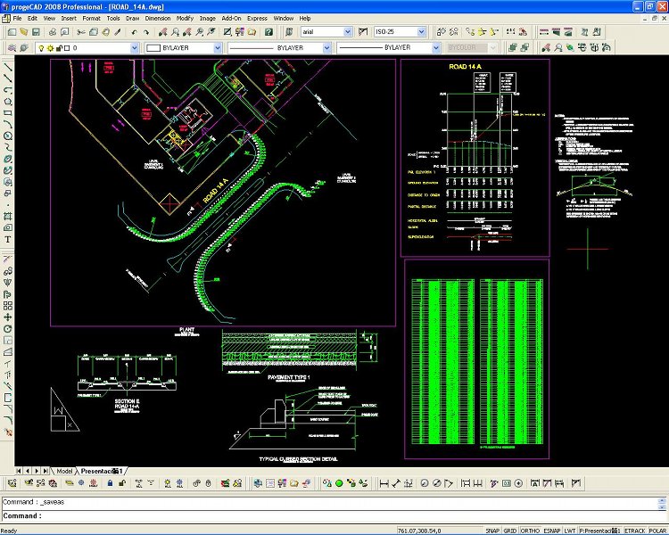
Civil Survey AutoCAD Clone Software, no learning curve
for AutoCAD users, Natively reads and writes AutoCAD
DWG files, no need for conversion! Includes Data
Colector File Import, COGO, Contours, DTM, Road Design,
Sections and Profiles. low-cost alternative to
otherwise high priced Land survey, coordinate geometry,
digital terrain modeling, and corridor design software
including working directly with AutoCAD DWG files.
Windows 7 32,Windows 7 64, AutoLISP, VBA, ADS
programming, import from PDF, Advanced Rendering, 3D
ACIS Solid Modeling included. Import and edit your
Raster Images, including Raster to Vector. Comes with
near 11,000 standard symbols and blocks. AutoCAD DWG
File 2.5 - 2008 Open and Save Compatible with AutoCAD
menus, scripts, fonts, etc. A Library of Blocks Symbols
for Electrical Mechanical Architectural Civil Survey
Hybrid DWG Raster Image Editing Vertical applications
for many industries. Google Earth export, Quick
Dimensioning, updated spell checker, DIESEL expression
support, over 1000 new CAD symbols, right-mouse click
context menus, improved speed and reliability, Advanced
Data Extraction wizard, one-click text editing, an
interactive purge command dialog, and one-click entity
grouping, layout print area visualization. eTransmit,
PDF, ECW, O2C, JPG, SVG XML image file support, Express
Tools, easy-to-use attribute editing, DWG redlining, in
place external reference editing, and Find and Replace
text and attribute search, Network NLM, USB mobile, and
corporate licensing options, over 300 new hatch
patterns. progeCAD Professional IntelliCAD is an easy
replacement for AutoCAD and AutoCAD LT!
Program details
Publisher
progeCAD USAE-mail
Contact the publisherPlatforms
Windows XPFile size
1696 KBFile date
10/15/2010License
SharewareExpires after
30 daysInstallation
Install & UninstallRecord updated
12/22/2010


