Ïîëèãîí: Êàðòà ïëàí
Version 5.2.3
Commercial Demo
Free
1 downloads
"Polygon" is a unique program for automation of
installation of borders of the ground areas and tap of
the earths.
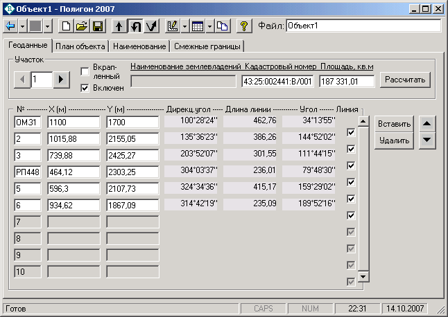
The program carries out calculation of the geodata,
builds the plan of borders of the earths, forms land
management business. It is compatible to programs
Word, Excel, MapInfo, AutoCAD, supports data input
from tacheometer files. At a maximum of possibilities
the program is simple and convenient, it is
recommended for wide circle of land surveyors.
Version 2008:
1. Possibility to change colour and line type, the
form and colour of each point is added. Types of
lines: usual, a dotted line, fat; colours: black, red.
The point form: a circle or a square, painted over or
not painted over; colours: black, red.
2. Names of sites in the plan now without a
Program details
Publisher
Ïàâåë ÁàòèùåâE-mail
Contact the publisherPlatforms
Win7 x32<br>Windows XP<br>Windows 2000<br>Windows 95<br>Windows 98<br>Windows ME<br>WinVistaFile size
6876 KBFile date
4/17/2013License
Commercial DemoInstallation
Install & UninstallRecord updated
5/16/2016

