
Create Better Maps with Global Mapper 13
Version 7.9.7
Shareware
$399.00
3 downloads
Global Mapper is more than just a utility; it has
built in functionality for distance and area
calculations, raster blending, feathering, spectral
analysis and contrast adjustment, elevation querying,
line of sight calculations, cut-and-fill volume
calculations, as well as advanced capabilities like
image rectification, contour generation from surface
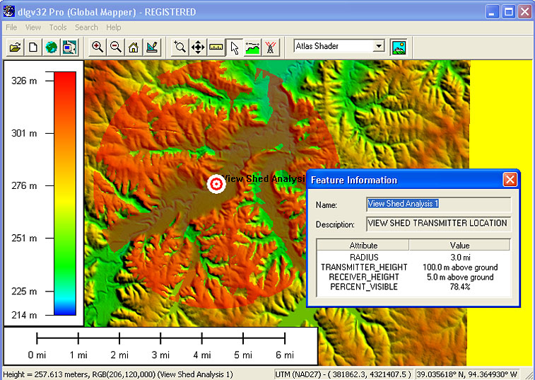
data, view shed analysis (including Fresnel) from
surface data, and triangulation and gridding of 3D
point data. Repetitive tasks can be accomplished
using the built in scripting language or
comprehensive batch conversion functionality.
Create Better Maps with Global Mapper
Experience the power of professional mapping
easy to use viewer/editor capable of displaying the
most popular raster, elevation and vector datasets
(now including GeoPDF?)
convert, edit, mosaic, reproject, print, track GPS
utilize GIS functionality on your datasets
unsurpassed technical support with no extra support
fees!
Global Mapper also includes the ability to directly
access multiple online sources of imagery,
topographic maps, and gridded terrain data. This
includes access to worldwide high resolution color
imagery from DigitalGlobe (watermarked access for
free), detailed street maps from OpenStreetMap.org,
and access to the entire TerraServer-USA/MSRMaps.com
database of USGS satellite imagery and topographic
maps free-of-charge. Global Mapper also has the
ability to easily access WMS data sources, including
built-in access to elevation data and color imagery
for the entire world, and to view elevation and
vector data in true 3D with any loaded data draped on
top of it!
Program details
Publisher
Ramka Ltd.E-mail
Contact the publisherPlatforms
Windows 98<br>Windows XPFile size
11511 KBFile date
11/1/2011License
SharewareExpires after
30 daysInstallation
Install & UninstallRecord updated
11/26/2011


