|
|
 GeoDLL Deutsch
-
Version
14.43
GeoDLL Deutsch
-
Version
14.43
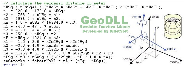
GeoDLL supports the development of geodetic software
on various platforms by providing geodetic functions.
GeoDLL contains precise calculations on the themes 2D
and 3D coordinate transformation, geodetic datum shift
and reference system converting, meridian strip
changing, user defined coordinate and reference
systems, distance calculations, Digital Elevation
Model, NTv2 handling and BeTA2007 support, Direct /
Inverse solutions, map function and geodetic
converting functions. The most important application
of GeoDLL is to include professional coordinate
transformations in own programs. These coordinate and
reference systems are supported: 1. The current and
many historical coordinate and reference systems of
all countries of the European Union (EU) including the
eastern extensions and the systems of the European non-
EU countries. 2. The European ETRS89 systems forced by
INSPIRE with respect to the continental drift. 3 .The
US and Canadian State Plane Coordinate Systems (SPCS)
and other systems of the North American continent. 4.
Many coordinate and reference systems of the countries
|