|
|
 TOPOWIN
-
Version
18.02
TOPOWIN
-
Version
18.02
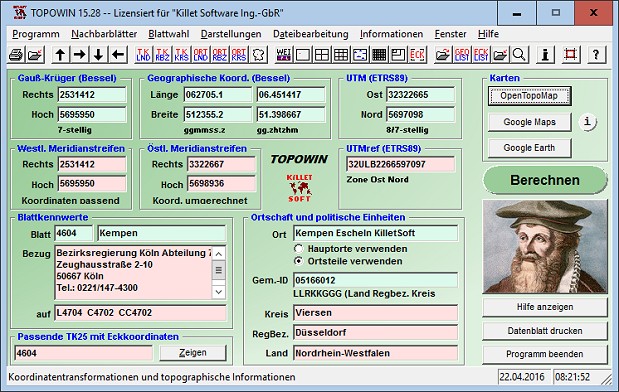
TOPOWIN is a state-wide register of the German
Topographic Cartographies, the German Basic
Cartography and of localities with geo references in
different coordinate systems. It is also a topographic
information system. In the division of planning and
execution of economical and scientific projects
frequently topographic documents are used. The program
TOPOWIN makes information available of the official
topographic cartographies and the German Basic
Cartography from the entire national territory in
suitable graphic views. It accomplishes different
coordinate transformations and inquiries. The program
was developed under co-operation of the land surveying
authorities of many German Federal States. For the
first time in the previous version TOPO (for DOS) and
later in TOPOWIN state-wide topographic information
were arranged for the data technical evaluation. The
program is for consulting engineers, planning
authorities and users of topographic maps a useful and
versatile tool. The topographical maps of different
standards, required for a project, can be determined
|