|
|
 RTOPO
-
Version
2.6c
RTOPO
-
Version
2.6c
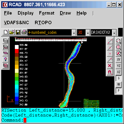
Is useful in topography for "Digital Terrain Modeling"
(DTM) by "Triangulated Irregular Network" (TIN),
representation (by 3DPOLY, SPLINE or BLOCK entities)
and editing (modify, delete or add) of 3D points, and
for triangulation, isolines (contour lines), color-
filled contour map, cross sections, longitudinal
profile, 2D entities (Line or PLine) projection over a
DTM, conversion of a TIN to a regular grid of points
and for conversion of existing isolines resulting from
maps in points and then in TIN. It exists a modifiable
library for codes and BLOCKs. The coordinates, the
code and the position (in 3DPOLY or SPLINE) of the
points can be modified interactively. You can
represent the geological stratification resulting from
drilling. The triangulation is performed on a convex
hull of a set of points or between an external contour
and possibly more interior contours. You can calculate
the volume, 3D area and center of gravity of some
bodies limited by 3DFACE entities. You can intersect
or divide two triangulations (or two sets of 3dmesh
and 3dface entities) or a triangulation by a
|